Jamnagar district (Gujarat): Chaturaben Bhagabai and Leelaben Premjibai Koli are sisters in their late forties in Jaliya Devani village in western Gujarat’s Jamnagar district. Both allege that their agricultural land, adjacent plots of one hectare each, were encroached by a man named Rajdeepsinh, who owns another plot of land adjoining their parcels.
“In January 2019, Rajdeepsinh stopped our families from entering our fields claiming that he owns the land as per land records,” said Koli.
On enquiring with a mamlatdar, the local revenue department official who deals with land disputes, Koli realised that the newly created land records had erroneously entered a portion of her land in this alleged encroacher’s name.
Gujarat was one of the first states to undertake the resurvey of rural land (agricultural and government land) under the union government’s Digital India Land Records Modernisation Programme (DILRMP) rolled out in September 2008. Between 2009 and 2018, the Bharatiya Janata Party-led state government implemented the resurvey across all districts.
Since the resurvey was initiated, thousands of landowners, such as Bhagabai and Koli, have run from pillar to post to seek corrections in their digital land records. Some stumbled upon the error after initiating a land transaction, others found out through access disputes as in the sisters’ case. Many may not be aware of the errors, but the issue was contentious during the just-concluded Gujarat election.
Kickstarting the election campaign in September, Aam Aadmi Party (AAP) chief Arvind Kejriwal declared that the land resurvey project would be scrapped if his party was voted to power. In his campaign speech in Dwarka, a town in coastal Gujarat and a Hindu pilgrimage site, he guaranteed a new resurvey, one of AAP’s six main promises to the people of Gujarat.
In their manifesto and campaign, the Congress party also promised to cancel the survey and initiate a new one.
The ruling BJP stayed silent on the issue in their campaign. Yamal Vyas, the party’s chief spokesperson in Gujarat, said their government had tried to address the farmers’ grievances at the local level. He said most errors in the new records were “technical problems” and “can be corrected”.
Inaccurate land records can have wide-reaching impact, from hampering property transactions to access to agricultural credit. Litigation over property records not matching the position on the ground may last years—a Niti Aayog paper in 2017 estimated that it takes an average of 20 years for a land dispute to be resolved in the country.
While the DILRMP sought to achieve complete digitisation of all land records, overall implementation in India remains slow, with the resurvey completed in only 13.58% of villages across the country. while disputes such as the thousands in Gujarat cropped up in Bihar too.
Glitches In Gujarat’s Mega Project
The last land survey in Gujarat was done between 1886 and 1920, initiated by the British and conducted by the princely states. As per the Gujarat Land Revenue Code 1879, authorities were required to conduct resurveys and update land records every 30 years. Post-independence, however, successive state governments ignored this rule.
In May 2012, after conducting a pilot survey of 2,742 villages over nearly four years, the then chief minister Narendra Modi released a resurvey manual specifying guidelines for executing a fresh resurvey of all rural lands in the state.
The state government invited private agencies to bid to conduct the resurvey. Nine agencies [see Table 1] were selected for conducting the resurvey.
In August 2018, the government abruptly halted the promulgation process (creation of new records) after having created records for over two-thirds of all villages in the state (records were promulgated in about 12,000 of the total 18,501 villages). The decision was taken after the government started receiving a large number of complaints seeking corrections in the new records.
Between 2020 and 2021, the Gujarat government reportedly received 1.68 lakh applications demanding a verification of the resurvey of their land.
In March 2022, responding to a question raised by the Congress, the state revenue minister Rajendra Trivedi told the state assembly that more than 90,000 of these applications had been disposed of. Four months earlier, in December, Trivedi had told the local media that complaints had been raised against 5.28 lakh survey numbers after the resurvey process.
Erroneous Records Create New Conflicts
A closer look at the types of complaints reveals that the private agencies that conducted the resurvey mostly relied on old maps and old land records instead of conducting a scientific measurement, as specified in their contracts.
As a result, lakhs of erroneous new digital land records were created. These fresh land titles triggered a barrage of land conflicts in rural Gujarat.
Newer disputes emerged within families and among neighbours, land transactions were delayed and farmers faced difficulties in using the new records as bank collaterals.
Though the private agencies were collectively blamed for the discrepancies, the state government allowed them to walk free.
“Officials, with insufficient staff, are yet to fix the land records even as farmers have been facing difficulties over the errors in the digital records,” said Pal Ambhaliya, president of Gujarat Kisan Congress, the farmers’ wing of the Congress party. Since 2015, Ambhaliya has been organising villagers seeking corrections in the new records and protests against the resurvey project at the district and state levels.
Burdened with a large number of complaints, the district officials have struggled to resolve these conflicts—for every correction, a fresh resurvey of the land parcel must be undertaken. A correction in one title leads to changes in other titles, a chain of corrections are required in the ‘records of rights’, the term used for land records.
State Govt Incurred The Bulk Of The Resurvey Cost
As per a March 2012 contract between the Gujarat government and Wapcos Limited, a surveyor firm, the survey cost was at least Rs 14,295 per square kilometre. The contract, accessed by Land Conflict Watch, was for surveying rural lands in Vadodara district.
While we do not have details of contracts with other companies, presuming this rate to have been matched in other deals, nearly Rs 370 crore would have been paid to the private agencies for surveying 2.58 lakh square kilometre of land across rural Gujarat. Around 93% of land has been surveyed in rural Gujarat.
In response to a query filed by this writer, under the Right to Information (RTI) Act, 2005, the union ministry of rural development said Rs 54.66 crore had been allocated to the state between 2012-13 and 2020-21 for the resurvey under DILRMP. This suggests that the majority of the project cost had been borne by the state government.
[[https://tribe.article-14.com/uploads/2022/12-December/09-Fri/rti.jpg]]
Fresh Land Disputes Between Brothers, Neighbours
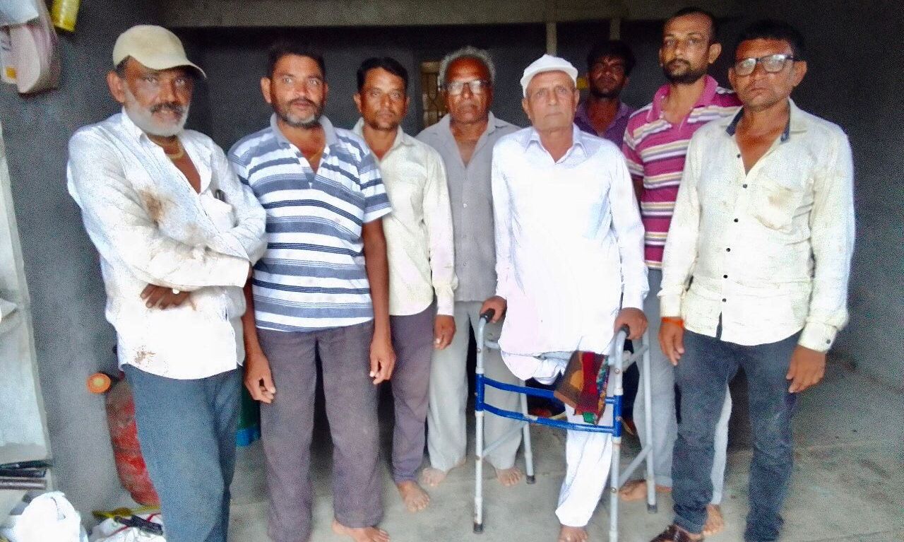
In land records offices across districts, queues of farmers waited to seek corrections in their land titles. This writer visited four such district offices and at least 10 villages spread across Ahmedabad, Devbhumi Dwarka, Rajkot and Jamnagar districts. In these villages, the majority of farmers talked about errors in the recorded area, shape and location of their agricultural lands in the new digital records.
Karshan Natha Joshi, 60, was one such farmer. Joshi owns an acre [0.4289 hectares] of land in Datrana village, 27 km west of Khambhalia, district headquarters of Devbhumi Dwarka. In August 2018, 40 farmers in Datrana and its adjoining Jawanpur village received notices for acquisition of their farmlands from the National Highways Authority of India (NHAI). The acquisition was for the construction of a proposed airstrip for emergency landing.
Although the proposed airstrip passed through Joshi’s land, to his surprise, he did not receive the notice. When he enquired with his fellow villagers, he found out that he was not alone.
Instead, several farmers whose land did not fall within the airstrip, as per the old village map, had received the acquisition notices.
Joshi checked his new land title and found out that the shape of his land parcel was wrong and incorrectly located in the new village map in the digital records.
“It is located 500 metres away from where it actually is,” said Joshi. He later submitted an application, twice, for correction of his land title, in September 2018 and March 2020. “Along with tens of other farmers in our village, I’m waiting for officials to resurvey my land and fix the records,” he said. “The delay is like a punishment.”
Adjacent to Joshi's agricultural land lies the farm of Devad Abha Chauda. While the proposed airstrip passes through his land, Chauda claimed that his younger brother Samat Abha Chauda, whose land is over 200 metres away from the proposed airstrip, received the land acquisition notice.
When the Chauda families checked the new records, they found that the land parcels of the brothers had been interchanged.
Devad Chauda’s farm also lies next to his older brother Lakhu Arjan Chauda’s farm land. In his complaint to the district land records office, Devad said that his land area had been reduced by 5%, from 2.4218 hectares to 2.3085 hectares, and that a part of his land was shown as his brother’s land in the new village map.
The errors resulted in disputes among the three brothers. “To sort out disputes, we filed applications for corrections with the district land records office first in October 2019, and again in December 2020, and again in April 2022,” said the eldest, Lakhu Arjan Chauda. “No official came to verify and correct the land record.”
For 2022, the deadline for filing complaints seeking corrections was extended to 31 December 2022. As the deadline approaches, no clarity exists on the actual number of complaints. The ruling party maintained that less than a lakh complaints remain pending, but in private, officials estimated a much larger figure.
“The new government after consulting with officials will decide whether to extend the deadline for filing complaints or not,” said Vyas.
‘Correction Of Records An Unending Process’
The district land records office in Ahmedabad has been receiving “at least five complaints on a daily basis”, said KP Goswami, a government surveyor. He told this writer that about 15-20% of landowners with grievances had approached his office for corrections. “This correction of land records appears to be an unending process.”
Corrections in area, shape and position of the documented land parcel requires officials like Goswami to visit the land in question and conduct a fresh survey.
“If the complaint is found to be genuine, then the officials send surveyors to conduct a resurvey of the land in question to make the necessary changes in the records,” explained Goswami.
The resurvey process is conducted in three phases—pre-survey, survey and post-survey.
In the pre-survey stage, the surveying agency gets access to all existing land records. According to the guidelines of the resurvey project, a gram sabha or a general body meeting of the village was to be conducted in the village to spread awareness about the resurvey.
The Process Of Creating Digital Land Records
To create digital land records, modern land survey technologies such as DGPS (Differential Global Positioning System), ETS (Electronic Total System) and GIS (Geographical Information System)-based spatial data processing software were to be put to use. These were specifically required by the contracts.
During the survey phase, agency surveyors equipped with DGPS or ETS machines were required to first measure the village boundary and then measure the land boundaries of all land parcels in the village.
In this method, DGPS or ETS machines are used to capture precise land boundaries and measure dimensions of the land parcel being surveyed. Then these ground measurements are linked with geographical data attributes [includes information on latitude, longitude, geographical features etc] in a GIS format to create a digital database. In simple terms, the survey firm is required to demarcate and locate all the pieces of land in a village on satellite imagery maps with precise measurements.
In the post survey phase, old tippons or maps are digitised and superimposed on the new land maps and any discrepancies in shape or area are to be recorded in a discrepancy register.
After the three phases, Land Parcel Maps (LPMs) were to be generated and distributed among landowners. Though this was specifically mandated by the contracts, the private companies failed to give all landowners such documents.
Agencies and officials were then required to conduct an adjudication process to verify and correct objections raised by landowners for a period of 30 days. This too was not followed.
While the LPMs of private lands were to be verified by the landowners concerned, the LPMs of the government land were to be verified by officials. After resolving all objections, the officials were required to give a go-ahead for promulgation or creation of a new record of rights for the entire village.
Relying On The Old For A New Record Of Rights
“... instead of accurately measuring each land parcel, the agencies took measurements only of government lands and of those lands where owners were present at the time of the survey,” a district superintendent of land records, who oversaw the resurvey project in two districts, said on the condition of anonymity.
For the remaining lands, the agencies relied on data from old maps and records to create new records.
The district superintendent of land records added that the remaining portions of the village were estimated, calculated and created by using data from the available records and by superimposing old maps on new maps that did not include any ground measurements.
The majority of landowners this writer spoke to claimed that they were not involved in the survey.
The Congress party has alleged “irregularities” in the project since 2012. Former president of the Gujarat Pradesh Congress Committee, Arjun Modhwadia, said that survey firms breached the agreement and that the government allowed them to walk free nevertheless.
Modhwadia said that the government is reluctant to admit that the agencies’ surveys were faulty. He claimed that admitting this would imply that “the officials genuinely allowed mistakes to happen as they were implementing it.”
The agreement between the government and the private agencies stated that “in the event of any deficiency in these services, the survey agency shall promptly redo or remedy without any additional cost to the client and carry out such modifications and or rectification as may be required”.
Since August 2018, the resurvey contracts with all the private agencies remained frozen.
At that time, the state revenue minister Kaushik Patel said in a press statement that the government stopped payments to erring agencies and “stern action” will be taken against those found guilty of irregularities. Patel was not reachable on the phone for a comment despite repeated attempts.
Emails sent to the nine firms that conducted the project and to the settlement commissioner and the state’s superintendent of land records NP Thakar, asking if the firms were found guilty of wrongdoing, remained unanswered.
Amit Trivedi of SKP Projects Private Limited, one of the nine agencies conducting the resurvey, said that his firm was awaiting directions from the government to begin and complete the resurvey in the pending villages.
In May 2017, a group of farmers alleged that there had been an “illegal” resurvey in Devbhoomi Dwarka and Jamnagar districts. They approached the Gujarat high court seeking action against officials and the firm IIC Technologies, which had won the contracts for surveying land in 12 districts. In Jamnagar, as per official data, 98.12% of rural land was surveyed.
In a reply submitted to the court on 9 July 2019, the state’s deputy director of land records defended the firm. He told the court that the officials carried out post-promulgation redressal as part of the resurvey project and that the grievances of the petitioners would be addressed.
On 10 July 2019, the court ruled in favour of the government and the firm, stating that the “authority concerned has undertaken an extensive exercise pursuant to re-survey project.”
[[https://tribe.article-14.com/uploads/2022/12-December/09-Fri/Gujarat%20HC.jpg]]
A land record is an asset required to secure one’s ownership over a plot of land, over its transactions and to access subsidies from the state, especially in rural India. In Gujarat, the resurvey project has created newer problems, said villagers like the two sisters from Jamnagar, at the cost of public money.
Table 1: Details of private companies contracted to conduct resurveys of rural land and district-wise area surveyed by them
[[https://tribe.article-14.com/uploads/2022/12-December/09-Fri/table.jpg]]
Get exclusive access to new databases, expert analyses, weekly newsletters, book excerpts and new ideas on democracy, law and society in India. Subscribe to Article 14.
(Prudhviraj Rupavath is researcher, land and forest governance, at Land Conflict Watch, an independent network of researchers studying land conflicts, climate change, and natural resource governance in India.)