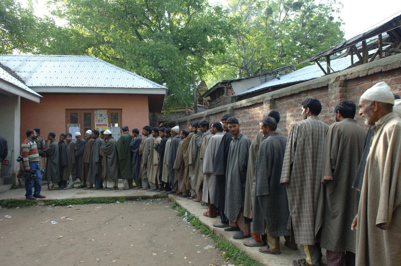
Jammu: At least 78% or 70 of Jammu and Kashmir (J&K)’s 90 assembly constituencies will be recreated, with evidence that the redistricting will reduce representation for areas with Muslim majorities, particularly in the Kashmir Valley, which is 95% Muslim.
This is apparent in the final report of a committee tasked to create new electoral constituencies in J&K, clearing the decks for the first assembly elections after its demotion to a union territory. On 30 March, home minister Amit Shah announced in Parliament that elections were indeed scheduled after the constituencies were redrawn.
But the exercise, said experts, is riddled with flaws, ignoring as it does the cardinal principle of population in conducting delimitation, or redrawing electoral boundaries, and does not explain how it has applied the laws and guidelines governing delimitation.
The former J&K state assembly had 114 seats, of which 24 were reserved for Pakistan-administered Kashmir, a region that India holds as occupied territory that will someday be reintegrated. The delimitation exercise, then, is limited to 70 assembly constituencies within Indian control.
A three-member J&K Delimitation Commission headed by former Supreme Court judge, Justice Anjana Prakash, was formed on 6 March 2020 and assigned to redraw and increase assembly and parliamentary constituencies in J&K, in accordance with sections 59 and 60 of J&K Reorganisation Act 2019 and the Delimitation Act 2002, respectively, which clearly state the latest census to be the primary basis delimitation.
“The idea behind a delimitation process is to ensure better access between the public and their representatives,” said Noor Ahmed Baba PhD, a professor of political science. Where necessary, other factors, such as geographical size and physical features of a constituency and “public convenience”—a reference to accessibility, particularly in remote areas—may also be considered, according to the laws governing delimitation.
Far from ensuring geographical compactness and public convenience, the geographical congruity of assembly constituencies has been disrupted in many instances. Much has been written about how allotting six seats to Hindu majority Jammu province and only one seat to Muslim majority Kashmir province is likely to change the political dynamics of Jammu and Kashmir.
Our analysis of the delimitation commission’s final report found the alteration of boundaries has made the Hindu vote a decisive factor in more constituencies than before. Areas with substantial tribal and scheduled caste (SC) populations have also been redistributed between constituencies—discarding ease of access and public convenience—in such a way that it would reduce the electoral influence of Muslims.
In January 2022, Article 14 reported how the principle that a state’s population determines the number of elected representatives remained the bedrock of India’s constitutional system but had been discarded by the delimitation commission. The commission, we reported, was proposing—a decade ahead of the original schedule—more legislature seats for Jammu, with the entire process called into question, in any case, because J&K’s 2019 reorganisation is pending before the Supreme Court.
On 29 March, two Srinagar residents filed a public interest litigation in the Supreme Court, challenging the delimitation exercise, asking why J&K was singled out for the redrawal of constituencies when it was frozen for all states until 2026.
Tearing Up J&K’s Constituencies
The redrawing of three of J&K’s 107 parliamentary constituencies by the delimitation commission reveals how they could be broken up and spread over two provinces that are geographically, culturally, linguistically and politically distinct.
Consider the Hindu-majority Lok Sabha constituency of Jammu-Poonch. The commission recommends that the Muslim-majority districts of Rajouri (62% Muslim) and Poonch (90% Muslim) be removed from Jammu-Poonch and added to the Muslim-majority parliamentary consituency of Anantnag, and the Kashmir areas of Shopian, Pulwama and Tral, almost entirely Muslim, merged with the Srinagar-Budgam constituency.
This would reduce Muslim representation in Anantnag from almost 98% to 84%, according to data from the 2011 Census, the latest available. These estimates exclude Kashmiri Pandit migrants who fled in the early 1990s after many were murdered (the estimates range from 85 to 600 over three decades) when insurgency began. If they are included, Muslim representation will reduce further.
In the north of Jammu province, Poonch is connected to South Kashmir via the Mughal Road, a fair weather road that winds through lush, scenic mountains and meadows but remains shut for more than five months every year due to snowfall.
The two major towns at both ends of the road are Shopian in Kashmir and Bufliaz in Poonch, 98 km apart and a trying two- to three-hour drive in good weather. The assembly constituencies of Anantnag, Kulgam, Bijbehara and Pahalgam—which are further away than Shopian from the Kashmir end of the Mughal Road—would be part of the Rajouri-Anantnag parliamentary constituency on the Jammu end.
“How are issues of geographical convenience and access addressed by linking two distinct geographical units that would be separated by the vagaries of harsh weather for half the year?” said Mohammed Yousuf Tarigami, a four-time legislator of the Communist Party of India (Marxist).
Besides, the difference of aspirations and cultures on both sides, how will that part of the electorate that does not share a language communicate with their elected representative on the other side, asked a political worker from Poonch, speaking on condition of anonymity.
And if the Shopian assembly constituency, including its main town through which the Mughal Road passes, is now supposed to be added to the Srinagar parliamentary constituency, it will be reduced to “an island” surrounded by the Poonch-Anantnag parliamentary constituency, said veteran journalist Mohammed Sayeed Malik.
If there is a design behind the delimitation exercise, said Malik, “it appears to be to rupture Kashmir’s homogeneity” and “dilute its identity”.
The odd recreation of the Rajouri-Anantnag parliamentary constituency is not an aberration.
Constituencies Split By Geography
The delimitation commission report, if accepted, will discomfort not just politicians who have nurtured these constituencies for years but also thousands of voters who will be detached from their traditional constituencies.
For instance, in Jammu’s Udhampur district, within which are contained three assembly constituencies, the commission has proposed another constituency in such a way that some hilly and inaccessible areas, instead of being retained in one constituency, have been divided and appended to two or more constituencies.
In the Chenani assembly constituency, several villages and panchayats (Dudu, Jakher, Sira, Pattangarh, Barmeen and Satyalta) have been transferred to the Ramnagar assembly constituency, even though they are not geographically connected. These villages are surrounded by Chenani on all sides and they have large schedule-caste populations: Dudu, 48.09% and Satyalta, 21.53%.
J&K previously reserved assembly seats for scheduled-caste candidates by rotation: Chenani had completed its 25 years and the reserved seat was likely to be shifted to Ramnagar, which is what the delimitation report also proposes, but only after adding panchayats and villages dominated by scheduled castes, irrespective of geographical congruity and ease of access.
“It is a complete wear and tear of the electoral map and constituencies without taking into consideration the ground position,” said Harsh Dev Singh of the Panthers Party, three-time MLA and a former J&K education minister. “There is no application of mind and no justification of what has been done.”
He alleged there was a pattern to the redrawing: to suit the interests of India’s ruling Bharatiya Janata Party (BJP).
‘Commission Used As A BJP Rubber Stamp’
The allegation, in Singh’s words, that the delimitation commission has been used as a “rubber stamp of the BJP” cannot be proven, but a lot of the electoral redistricting does appear to benefit India’s ruling party.
Consider the village of Jakhani, inhabited by 334 people, 92.8% of them scheduled tribes, on the outskirts of Udhampur town, a BJP stronghold. Instead of retaining it in Udhampur constituency, it has been electorally joined with Chenani, thus removing from Udhampur constituency voters, who traditionally do not vote BJP.
There are other indicators of how the rejig could consolidate Hindu votes and help the BJP make inroads in areas where the party has few voters.
An example is the district of Rajouri, which until 2014, contained four assembly constituencies: Nowshera, Kalakote, Rajouri and Darhal. The delimitation proposal carved out a new constituency, Thanamandi, and reserved both Darhal and Thanamandi as scheduled tribe constituencies.
Nowshera remains a Hindu majority constituency after the redistricting. The amalgamation of Hindu voters is evident in the other two general assembly constituencies:
–In Kalakote constituency, 51% of the population is Muslim, with scheduled tribes comprising eight in 10 of all Muslims. Sunderbani tehsil, which is 86% Hindu, has been severed from Nowshera and attached to Kalakote, thus ensuring a 64% Hindu majority.
–Rajouri constituency, comprising primarily of Rajouri tehsil, is 70% Muslim and 28% Hindu. Rajouri town is 57% Hindu, with the Muslim population concentrated in four Muslim majority patwar halqas or administrative units in a tehsil administered by a patwari or revenue officer: Doongi, Fatehpur, Sohna and Bagla, with Muslim scheduled-caste populations of 48.99%, 55.72%, 91.54% and 57.99. With these four areas now removed from Rajouri to the Thanamadi assembly constituency, Hindus have a greater influence than before on electoral fortunes.
Congress spokesperson, Ravinder Sharma, who is from Sunderbani, termed the redrawing of Kalakote as “thoughtless and reckless”.
“Socially, culturally and geographically, Sunderbani and Nowshera have been together for 70 years,” said Sharma. “This will inconvenience voters of the area.”
Like others, Sharma questioned why the delimitation commission took two years to redraw boundaries in making decisions not informed by factors of either population, culture, language and administrative access.
The majority of constituencies have been disturbed “partially or fully”, said Sharma, with many areas artificially clubbed with others in such a way that it will take a long time to fully understand the changes.
“But it is clear that it suits BJP,” said Sharma.
The Curious Case Of Scheduled Tribe Reservations
Nine seats have been reserved for scheduled tribes in accordance with the Delimitation (Amendment) Act, 2008, and the J&K Reorganisation Act. The scheduled-tribe population is spread across several districts but by reserving five out of nine seats solely in the twin districts of Rajouri and Poonch, traditional ethnic divides are likely to deepen.
Two out of five seats in Rajouri and all three in Poonch are now reserved for scheduled tribes, converting Poonch into an exclusive scheduled-tribe electoral area and leaving the non-scheduled-tribe population of Poonch district unrepresented. If a constituency is reserved for scheduled castes of scheduled tribes, the entire electorate can vote, but only for someone from a scheduled tribe.
Rajouri and Poonch are border districts with complex demographic dynamics. In both Rajouri and Poonch, 36% of the population is from traditionally pastoral Muslim tribes called the Gujjars and Bakerwals, who speak Gojri and have a distinct culture. The rest of the population, both Muslim and Hindu, speak Pahari, a dialect of Punjabi.
In Poonch district, 10% of the population is Hindu and Sikh, mostly concentrated in the town of Poonch and others like it, whereas the rural areas are populated by Muslims, primarily scheduled tribes and Paharis.
Characterised by neglect and backwardness, Rajouri and Poonch have a 70-year history of being in the middle of violence, war and border skirmishes between India and Pakistan. They are divided by religion, caste, ethnicity and language.
Electoral politics and the political narrative in Rajouri and Poonch are determined by the Gujjar-Pahari divide and the Hindu-Muslim divide, explained journalist and author Zafar Choudhary.
With the boundaries of the five assembly constituencies in Rajouri district redrawn, as we explained, to ensure a Hindu majority in three and reserve two for scheduled tribes, those disempowered most will be Paharis, primarily Muslims.
On 24 October 2021, during his visit to J&K, union home minister Amit Shah spoke about how Gujjars and Paharis could benefit “by becoming ministers”. He did not get into specifics and promised every district in Jammu with “helicopter services” to Jammu city.
Ever since, the BJP’s Pahari leaders now speak of Shah’s “assurance that Paharis would be accorded ST (scheduled tribe) status”, meaning they would be eligible for reservations in jobs, education and government programmes.
Choudhary said that this ambiguity had allowed the BJP to make Gujjars and Bakarwals apprehensive about the dilution of the scheduled-tribe status and diluted Pahari anger at losing electoral heft in delimitation.
“This is why the tribals have celebrated the move in muted tones and the Paharis are yet to react,” said Choudhary.
If Paharis are accorded tribal status, this will not only make the reserved seats in Rajouri-Poonch districts irrelevant, but it would also alter the region’s political dynamics and create further complexities. The Jammu & Kashmir Reservation (Amendment) Act 2014 defines Paharis not in terms of location but linguistic identity: Paharis also include about half a million Hindu and Sikh refugees from Pakistan Occupied Kashmir (POK), who settled mostly in Jammu district since 1947.
The Power Of BJP Pressure
The final delimitation report is by and large a cut, copy, paste version of the first two drafts presented in December 2021 and February 2022.
The only major amendment is that the February draft of the panel had assimilated Suchetgarh constituency in Jammu with neighbouring R S Pura, which had been reserved in 1996 as a scheduled caste constituency for 25 years after a new constituency of Suchetgarh was carved out in the 1995 delimitation.
The second draft proposal had redistributed various segments of Suchetgarh between R S Pura (retained as a scheduled caste or SC constituency), Bishnah and Jammu South, triggering resentment that transcended political divides. This mens that non-SCs will not be able to contest elections, a setback to upper-caste Hindus.
According to the rotational policy of reservation, R S Pura had completed 25 years as an SC constituency and Suchetgarh, with an SC population of over 30%, was most likely to be reserved for SCs.
It was in this region that 200 BJP activists and leaders resigned after the second draft was made public.
In the final proposal, Suchetagarh has been carved out as a separate SC constituency, but almost all of R S Pura has been clubbed with Jammu South, making this the largest constituency in J&K with a population of 325,000, double the average size of other constituencies, violating the electoral principle of uniformity.
Picking And Choosing
The delimitation exercise is replete with other legal and procedural flaws, said experts, that do not follow electoral and geographical logic.
The commission, while recommending six additional seats for Jammu province and one for Kashmir, had overlooked the core criteria of population and given precedence to “secondary considerations”, said Justice (Retd) Hasnain Masoodi, a former judge of the J&K High Court and currently a Lok Sabha member from the National Conference.
Those secondary considerations include, according to the Delimitation Act, geographical compactness, physical features, boundaries of administrative units, communication and public convenience.
Jammu province occupies 62% of J&K and Kashmir 38%; Jammu’s population share is 43.6% compared to Kashmir’s 56.3%. But while Jammu’s seat share has been increased from 37 to 43 in the delimitation proposal, Kashmir will get 47 instead of 46.
Kashmiri parties, such as the National Conference and the Peoples Democratic Party, have accused the “political agenda” of the BJP as “dictating the show”.
Though geographical handicaps have been offered as an explanation, the Kashmir Valley remaining cut off in the harsh winters have not been considered. Besides, the rationale for the distribution of six news seats within Jammu appears to defy the logic of territorial size, terrain or population.
Of the six districts, two—Samba and Kathua—lie in the plains and Reasi straddles the foot-hills and the remote mountains. The plains of Jammu are Hindu majority but that changes up in the mountains. Muslims are between 53% to 58% of Doda and Kishtwar districts, each of which have got a new assembly seat.
An alteration of boundaries could consolidate the Hindu vote and favour the BJP: the Muslim vote is divided between three parties, a factor that the BJP exploited to win, for the first time ever, three of four assembly seats in the two districts in the 2014 assembly elections.
Kishtwar, the largest district in J&K at 7,737 sq km, about a fifth of the entire union territory, is sparsely populated with 231,037 people and many areas without roads. It has been given one more seat, apart from its existing two, but so has Doda district, with an area of 2,306 km and a population of 409,576, 46% Hindu); and Reasi, with an area of 1,719 sq km (seventh-largest in Jammu division) and a population of 314,714 (third lowest populated in Jammu division), 49% Hindu.
Compare Doda and Reasi to Anantnag in the Kashmir Valley. Anantnag, which is 98% Muslim, is spread over 3,574 sq km, the second-largest district in the Valley and third largest in J&K, with a population of 1.07 million, third largest in J&K, after Jammu and Srinagar.
Anantnag has areas that are inaccessible for over six winter months: It had six assembly seats in 2014, with an average population of 178,000 per seat, but has not, for reasons unknown, been given any more seats.
Inventing A New Category
A new kind of criterion has been introduced in the delimitation exercise: “border area”, based on which new constituencies have emerged in the district of Samba (86% Hindu) and Kathua (88% Hindu) in Jammu.
“This norm has been invented and no such provision exists in the Delimitation Act,” said Masoodi, the former high court judge, who alleged the new term allowed more seats to Hindu majority areas, benefitting the BJP. That certainly appeared to be the case with Samba and Kathua.
Samba with a population of 318,611 (the sixth-least populated district in J&K and fourth-least in Jammu province) has the smallest area at 904 sq km and had 2 assembly seats in 2014.
Compare this to Poonch, a border hill district on the line of control, far more inaccessible than Rajouri and Kupwara. Poonch has an area of 1,674 square km (eighth-largest in Jammu division but almost double that of Samba), a population of 476, 820 (fifth largest in Jammu division) and three assembly seats with an average of 159,000 per seat, the same as Samba.
While releasing the first delimitation draft in December 2021, the Commission explained that among other considerations, border areas had been included in view of their “inhospitable conditions”.
Both Samba and Kathua, now given additional seats, lie on the international border. However, this logic has not been applied in the districts of Rajouri (62.7% Muslim) and Poonch (90.4% Muslim, which lie along the Line of Control (LoC) between India and Pakistan and endure more shelling and firing from across the border than Samba and Kathua.
Challenging Fundamental Errors
The delimitation law gives broad undefined powers to the Commission but lays down clear guidelines about constituencies, including for scheduled caste and scheduled tribes, must be created on the basis of population, how they must “geographically compact” and consider “facilities of communication and public convenience”.
According to the Delimitation Act, once the report is published in the gazette, the recommendations are final and cannot be challenged according to Article 10(2) of the Delimitation Act 2002 and Article 329 (a).
“If there are fundamental flaws in the report that violate basic considerations of population, geographical congruity and convenience of the electorate, and the report is detrimental to the interests of the larger public, they can be challenged and the courts can take cognizance,” said Sharma the Congress spokesperson.
The National Conference in its written objections to the report has already raised a constitutional issue: The delimitation of J&K, Masoodi said, is born out of J&K Reorganisation Act, which is “constitutionally suspect” and has been challenged in the Supreme Court, where hearings in a slew of petitions, including one by his party, have been pending since 2019.
The future is unclear.
“The minute details of the cartographic divisions are yet to be studied,” said a political analyst who did not want to be named, given the sensitivity of the issue, but added that some fine points of the blueprint reveal that “the Kashmiri and Muslim identity would be limited, giving Hindus a more decisive role in voting patterns”.
“Whether this is being done by design, it is difficult to say at the moment,” he said.
Baba, the political science professor, agreed that one can only “speculate” that there is an attempt to engineer artificial fragmentations to enrich the BJP vote bank. “But that’s only speculative,” he said.
What is certain is that the distortion of J&K’s political map is not based on the recognised cardinal principles, said experts.
“It is not normal to destroy socially, politically and geographically compact constituencies and carve out new ones,” said Baba. “It is an experiment that defies any logic or rationale.”
(Anuradha Bhasin is Executive Editor of the Kashmir Times.)